Theoretical Foundation
Hamburg records thousands of traffic accidents every year - from fender benders to fatal collisions. Accidents at junctions, frequent involvement of cyclists and pedestrians and a high number of turning and rear-end collisions are striking. In order to be able to analyze the causes in a targeted manner, several pieces of data are required. Accident locations, parties involved, time of day, weather conditions, traffic density and some other information help to derive effective measures for accident prevention via a data-based analysis.
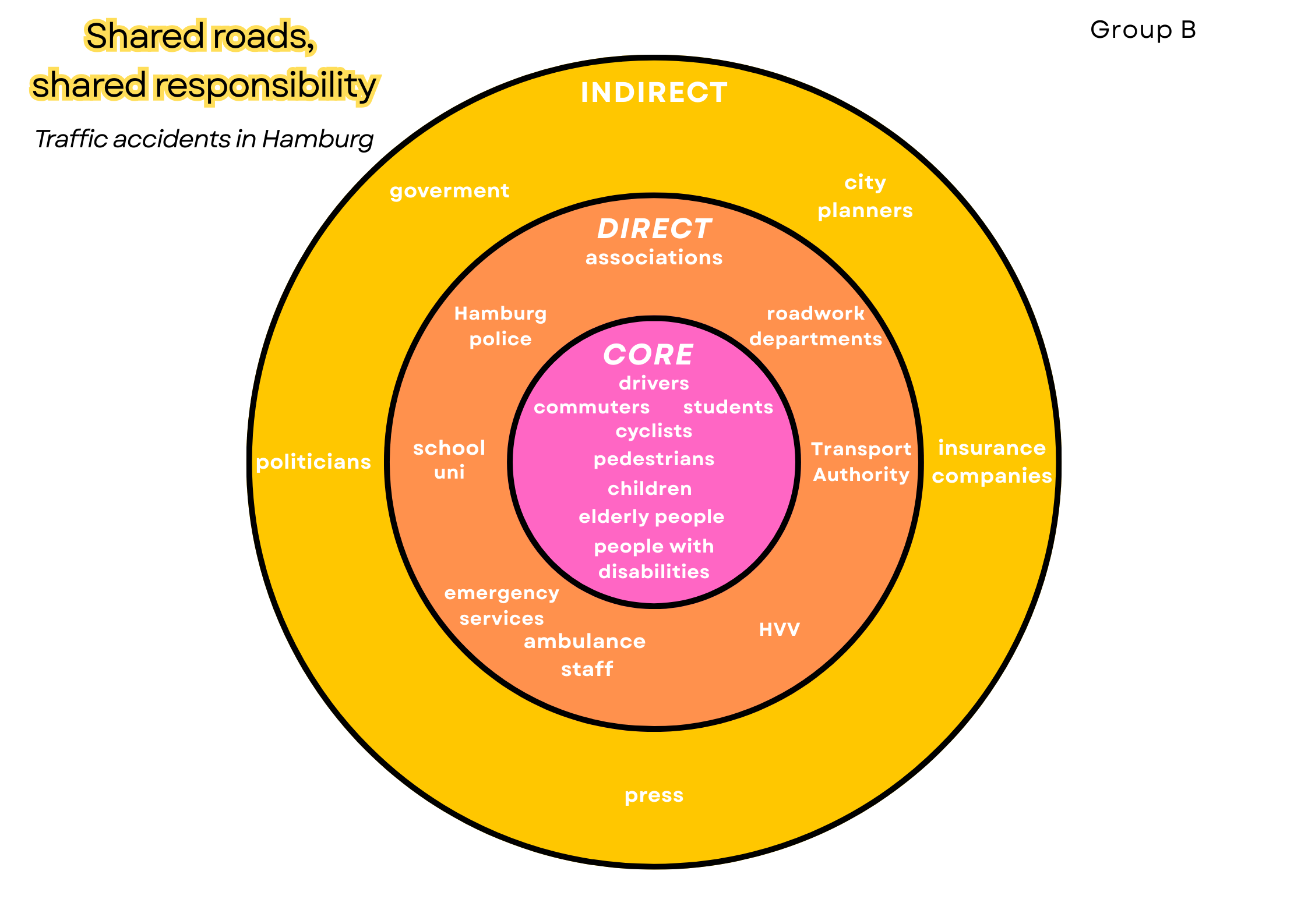
Stakeholders
The stakeholder landscape includes:
- Citizens: Primary data providers through GPS, apps, and reports.
- City Planners & Municipality: Use data for planning interventions.
- Transport Authorities: Improve infrastructure and safety measures.
- NGOs: Advocate for safer and more equitable transport policies.
- Academia: Analyze spatial-temporal accident patterns.
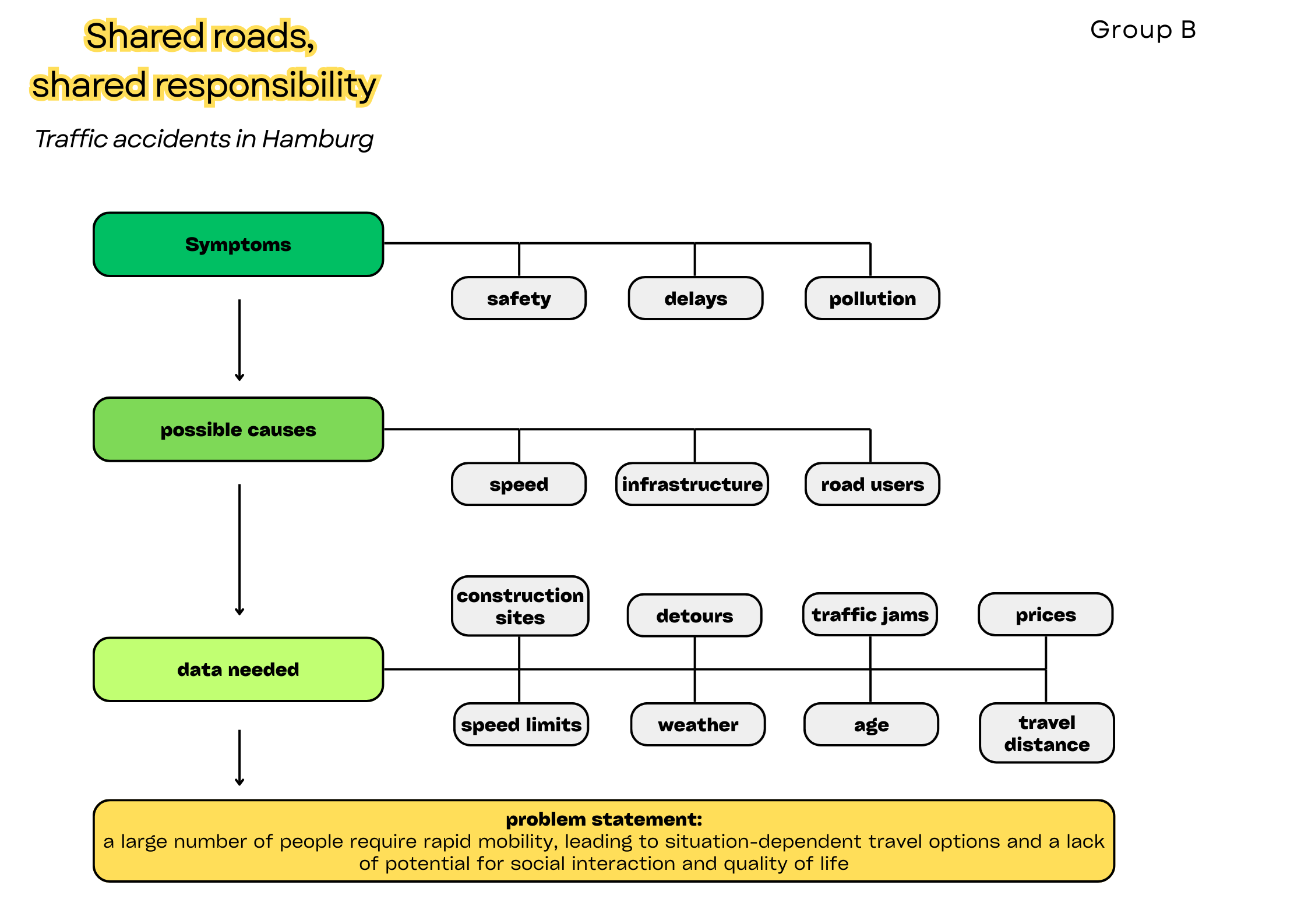
Methods
Data from the City of Hamburg, federal statistics and the Unfallatlas (https://unfallatlas.statistikportal.de) were collected, cleaned, georeferenced, and analyzed. Kepler.gl and Datawrapper were used for interactive visualization. The project adhered to Tufte's principles of minimalism and clarity, using contrast and consistent labeling to improve comprehension.
Results & Recommendations
The analysis shows that traffic accidents in Hamburg are concentrated around intersections, during rush hours, and on weekdays – with Thursday emerging as a critical day. Cyclists stand out as particularly vulnerable road users, which is consistent with patterns reported through citizen-sourced safety data.
In response to the feedback, we refined our interpretation of the results and introduced normalised indicators. When adjusted for road length (accidents per kilometre), Hamburg shows a higher accident density compared to the national average, particularly along urban collector roads. Data from INKAR indicates that Hamburg’s motorisation rate is lower than the German average, reflecting a higher share of cycling and walking. This modal split explains the relatively high proportion of accidents involving vulnerable road users.
Analysis by collision type confirms that car-to-car crashes are the most frequent, typically with lower severity, whereas car-to-bicycle and car-to-pedestrian incidents – though less common – disproportionately account for serious injuries and fatalities. A comparison with other German states, especially Berlin, reveals that when normalised by population and road length, Hamburg’s overall accident rate is similar; however, the share of cyclist and pedestrian accidents is higher. This strengthens the case for targeted infrastructure measures.
From these findings, the following recommendations can be derived: expansion of separated cycling lanes in high-exposure areas, redesign of crossings to improve pedestrian safety, and the continuous use of normalised indicators to monitor and evaluate safety interventions over time.