Wandsbek Markt
Bike Lanes and Conflict Areas
Improving cycling safety through the analysis of conflict areas between cyclists and pedestrians at one of Hamburg's busiest transport hubs.
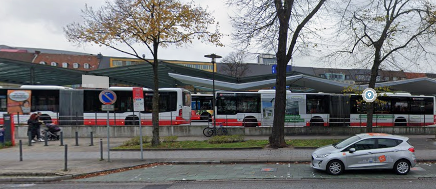
With the U1 subway line and several bus routes, Wandsbek Markt is one of the largest public transport interchange hubs for pedestrians in Hamburg. Nevertheless, it has further potential that we aim to unlock and fully utilize as part of this project.
One of the first things we noticed was the cycling infrastructure. The bike lanes are very narrow, making it impossible for two cyclists to ride side by side. As a result, cyclists often have to move onto the sidewalk when attempting to overtake one another.
The situation is further complicated by the ongoing construction work. Because of the construction, buses are unable to stop at the island and must instead use the main road. Consequently, especially during rush hour, large numbers of pedestrians gather along the streets.
Since the sidewalk and the bike lane are almost identical in color, it is difficult to distinguish between them. For these reasons, there is currently an increased risk of conflicts between pedestrians and cyclists.
Bike Bell Heatmap
On the interactive map, you can click on the heatmap areas to see the percentage of cyclists who ring their bells in each location. This helps identify hotspots where blocked paths or other obstacles lead to frequent bell use.
Conflict Zones and Potential Areas
Explore the interactive map to identify cycling conflict zones and potential improvement areas. By clicking on specific areas, you can access detailed explanations of the identified issues and opportunities.
Recorded Bike Route
Follow the cyclist’s journey through the mapped route. The recorded speed data highlights locations where cyclists had to slow down, brake, or ring their bells, revealing potential obstacles and areas of conflict along the way.
First, it should be noted that the conflict areas have largely resulted from the ongoing construction work. Nevertheless, it should be emphasized that the temporary traffic management during the construction phase does not appear to have been fully considered, and that some of these conflict areas could have been avoided from the outset.
For example, clearer signage for the temporary bus stops, as well as designated boarding and alighting areas in certain locations, could have prevented passengers from stepping directly onto the bike lane.
However, the construction work does not justify the narrow and, in some cases, poorly visible cycle lanes. These should be widened and more clearly marked to improve their visibility.
Towards a More Bike-Friendly Environment
Explore the interactive map of proposed cycling improvements. By clicking on individual measures, you can view detailed explanations of each intervention and its potential impact on the cycling experience.
Before vs After
By making cycling around Wandsbek Markt more attractive and safer, we can make an important contribution to reducing car traffic and improving the local transport situation. With well-designed, safe, and clearly marked cycle paths, areas of conflict can gradually be reduced, making Wandsbek Markt an even more livable place for people around Wandsbek Markt.
Sources
- Cycle path data: Hamburg Geoportal
- Bicycle parking data: OpenStreetMap data retrieved using Overpass Turbo
- Map creation: uMap , with additional editing by the project team
- Recorded bike route visualization: Kepler.gl
- This website's CSS styling and English translations were created with the help of Claude.