

Traffic Safety for Pedestrians and Cyclists in the Wandsbek-Markt Area
Characteristics of Wandsbek-Markt Area
Wandsbek Markt is a transit hub due to the convergence of the U1 subway line, the bus terminal, and major roads which are classified as magistrals (major arterial roads) 7 and 11. This major transportation hub creates tension among the wide variety of road users.
In 2025, approximately 920,000 cyclists were counted at Wandsbek Markt, which is about 2,500 cyclists per day. In the same year, the subway station recorded an average of 48,000 passengers per day, while the bus station recorded the highest number, with 57,000 passengers per day (Transparenzportal Hamburg, 2026). This volume gives rise to various problems, which we would like to present and discuss below.
The following map provides an overview of eastern Hamburg, highlighting the magistrals 7 and 11 as well as the bicycle path network. The study area is located exactly at the intersection of these two arterial roads. The magistrals are at the heart of the City of Hamburg's "Masterplan Magistralen 2040+". The goal is to transform the large, often noisy arterial roads into livable and versatile urban spaces. In this context, bike paths are of great importance. In the bike path network shown on the map, a distinction is made between bike lanes (blue), cycle streets (purple) and bike paths (red).
The map shows that Hamburg already has an extensive network of biking routes. In the following section put the quality of the network to a test and identify problems in the area by way of example with the Wandsbek Markt hub.
Critical Analysis
For our analysis we zoomed in and identified a handful of core problems, that lead to less safe bike paths, conflicts between different road users or contribute to an overall hostile cycling experience.
When it comes to the protection from cars, the city already took precautions by building bike paths entirely separated from car lanes. The paths only cross car lanes at intersections, most regulated by traffic lights. Only two instances of turning lanes in the east of the plaza were found to pose a risk. However the grade separation exclusively was realised at the expense of the pedestrian paths.
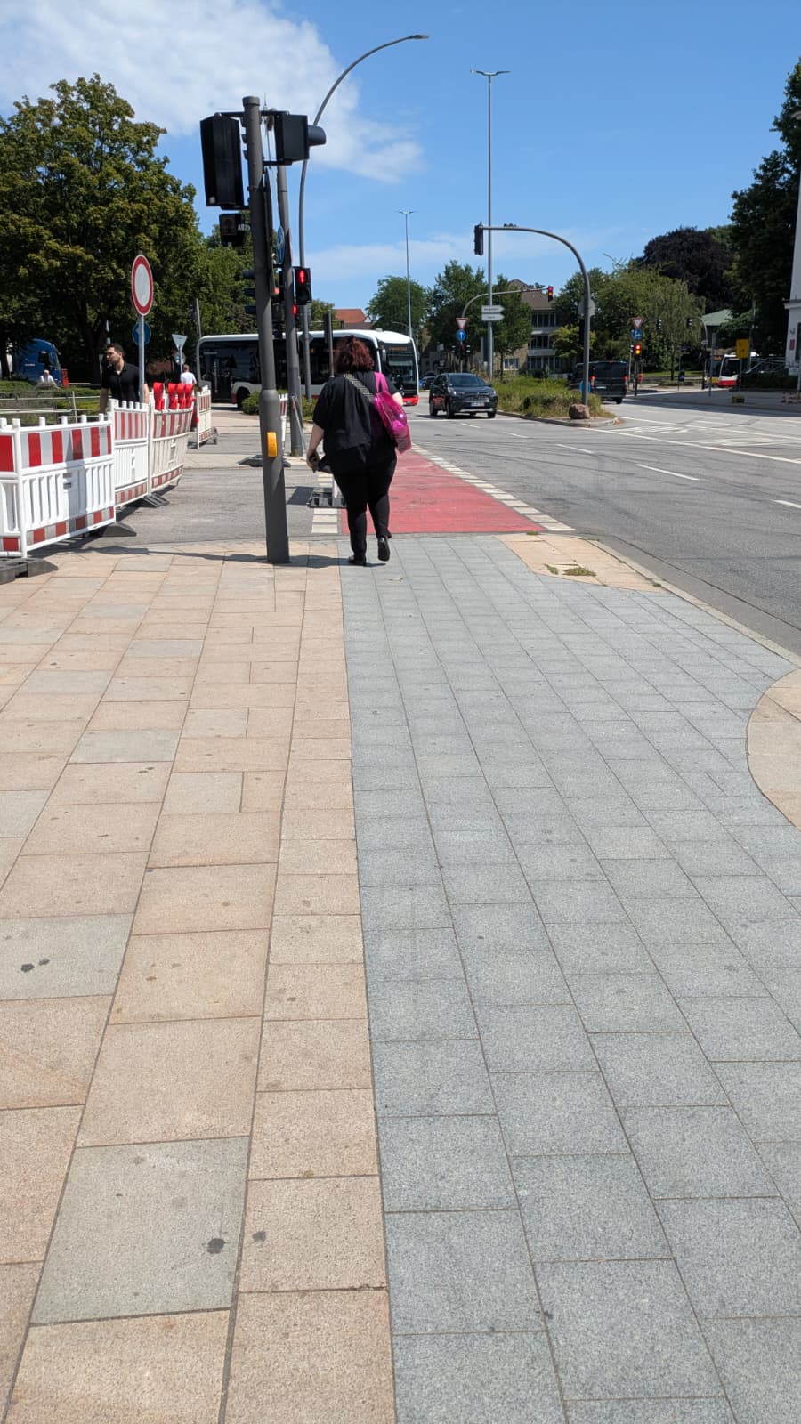
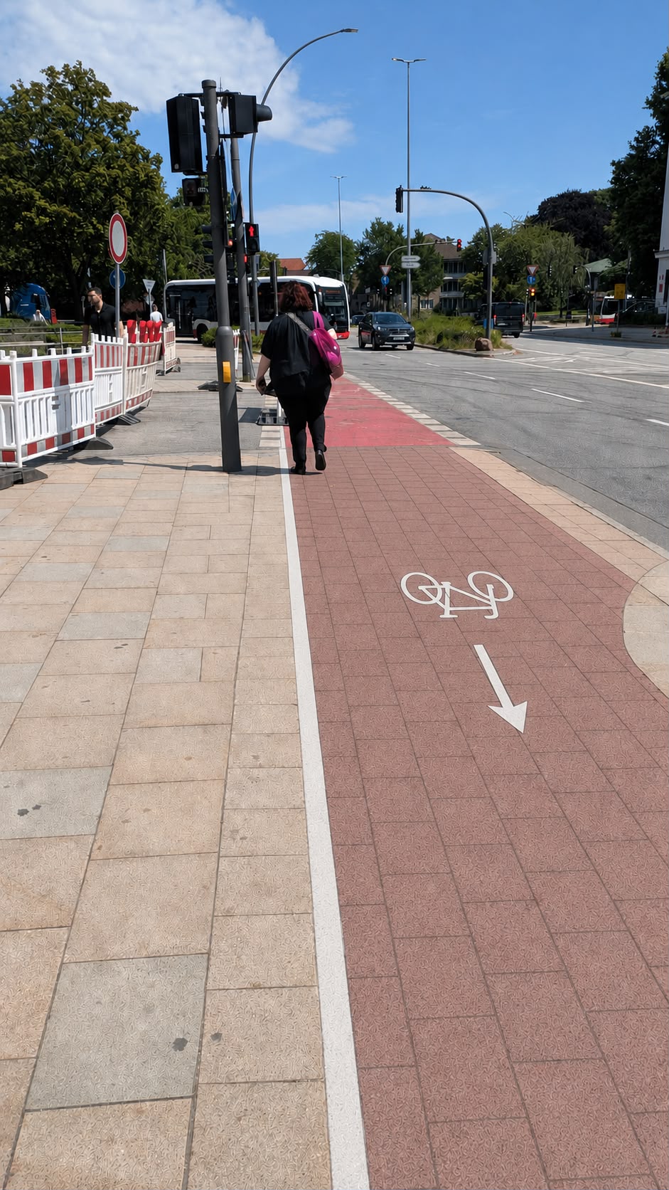
Cycling paths take up a lot of space on the sidewalks, especially at the intersections. The relationship between cyclists and pedestrians is characterized by conflicts, caused by insufficient signage and marking of the bike paths, or routing of cycle paths. Close encounters, bikers ringing their bells or other conflicts are a regular occurence. Hot spots are traffic lights with high pedestrian volumes and the bus stops along the southern end of the plaza.
The particularly short green phases of the pedestrian lights, sometimes as short as five to ten seconds, contribute to large numbers of pedestrians accumulating at the lights, often blocking the bike paths that run directly past the crossings and leave little to no room to wait.
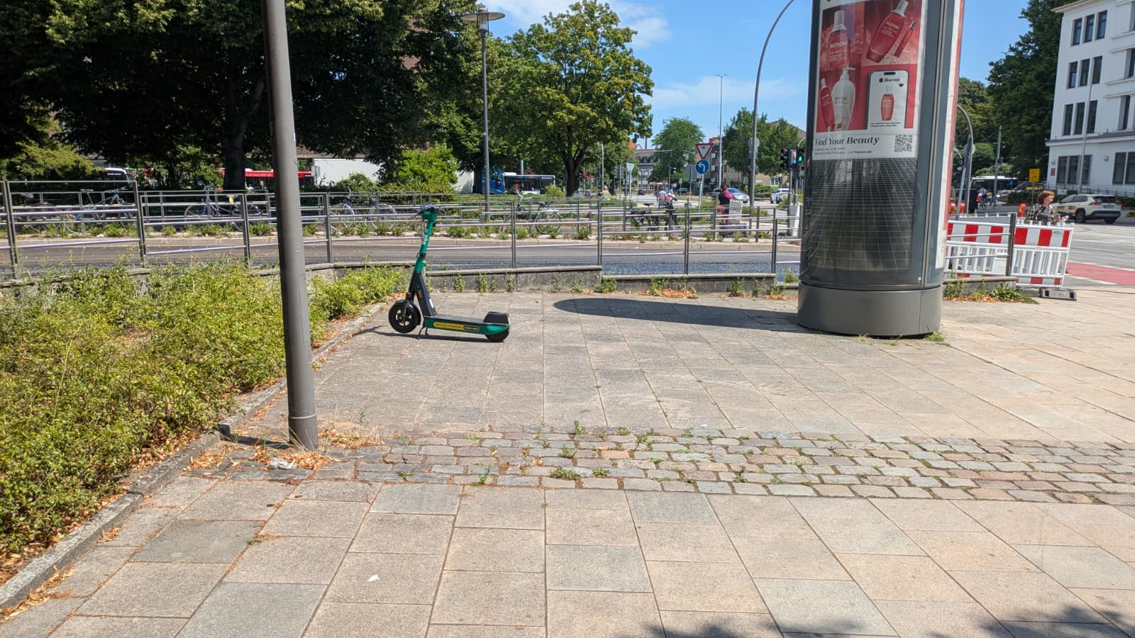
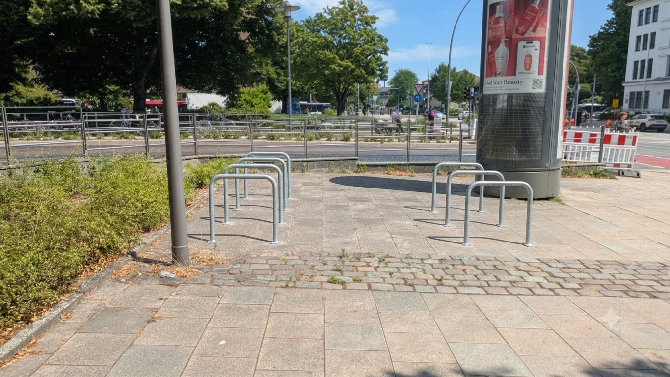
Finally, a lack of bike storage impacts both cyclists and pedestrians. Cyclists at Wandsbek Markt are inconvenienced and have to deal with a large number of bike thefts in Hamburg, as reported by ADFC. These factors weaken the role of the transit hub, that Wandsbek Markt station is expected to play. Biking as a viable solution for the last mile, especially for commuters, depends on the availability of sufficient and secure storage solutions. A number of bikes is locked along pedestrian walkways, obstructing the paths, existing parking spaces are overcrowded. The secure "Bike+Ride" storage box available at the site meanwhile is almost empty, presumably because of its location, lack of signage and pricing.
Short-Term Planning Suggestions
In the following section we will outline two short-term interventions that require little resources, but might have a large impact.
Outlook and Long-Term Planning
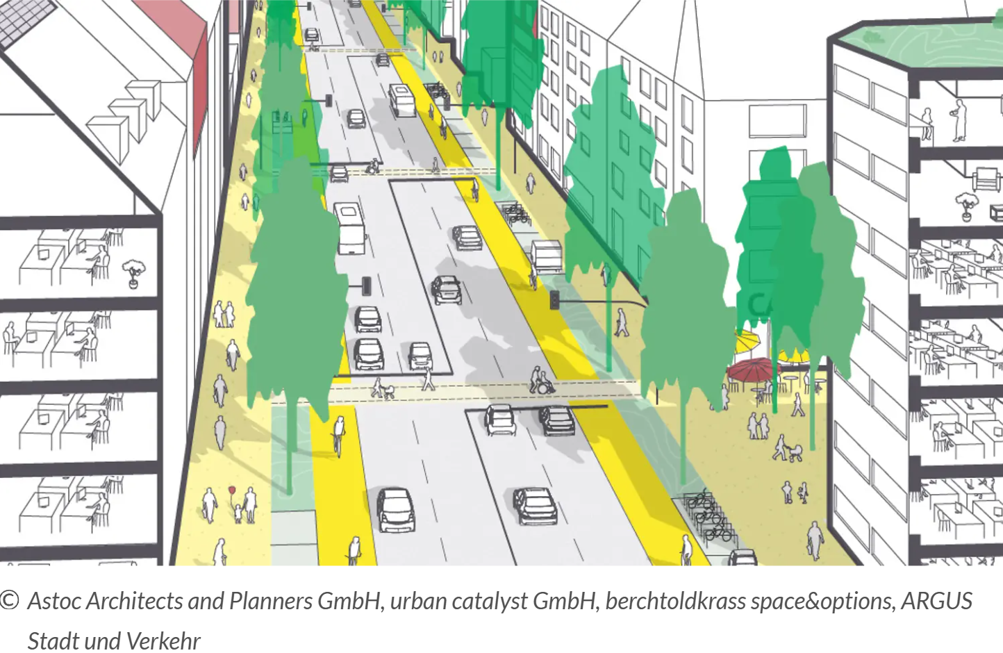
The City of Hamburg's master plan has already identified many of the same problems that we have identified and outlines more long term solutions. Moving the bike lanes off the sidewalks and establishing grade separated bike paths would would eliminate the hazardous situations we have highlighted. There are several model proposals, that are meant to be applied across all the magistrals, most of them calling for relocating and sufficiently separating the bike lanes. The proposal shown effectively separates the bike lane and sidewalk with a grass verge.
Planned measures for Wandsbek include reducing the six lanes in sections of Wandsbeker Marktstraße to four traffic lanes, calming Schloßstraße by restricting the traffic that comes through, relocating the bicycle lanes and improving public spaces. These changes directly address the problems identified during our field study by reducing conflicts between cyclists and pedestrians, creating more space for pedestrians and making more spaces for bike parking spaces, overall much improving the quality of this important transport hub.
Interactive Map
Have a closer look and zoom into the analyzed area, to find out more about traffic safety at Wandsbek Markt:
See full screen in new tab and zoom in to explore the complete interactive map with all details
References and digital tools
- Behörde für Stadtentwicklung und Wohnen (2024): Masterplan Magistralen 2040+
- Transparenzportal Hamburg (2025): hvv Fahrgastzahlen 2025
- Data published under dl-de/by-2-0 by Freie und Hansestadt Hamburg
- Radkultur Hamburg (2026): Wandsbek Markt
- DeepL: used for translations and rephrasing
- ChatGPT and Google Gemini: used to generate images for visualizing planning concepts (comparison-slider)
Last updated: July 2026