Urban field study · Hamburg

Wandsbek Markt

Reading the square through movement, infrastructure, conflict and the everyday quality of public space.

53.571° N 10.068° E Hamburg, Germany
Scroll to explore
PUBLIC SPACEMOBILITY CONFLICTPERCEPTION INFRASTRUCTUREPUBLIC SPACE MOBILITYCONFLICT PERCEPTIONINFRASTRUCTURE
01

One place.
Several realities.

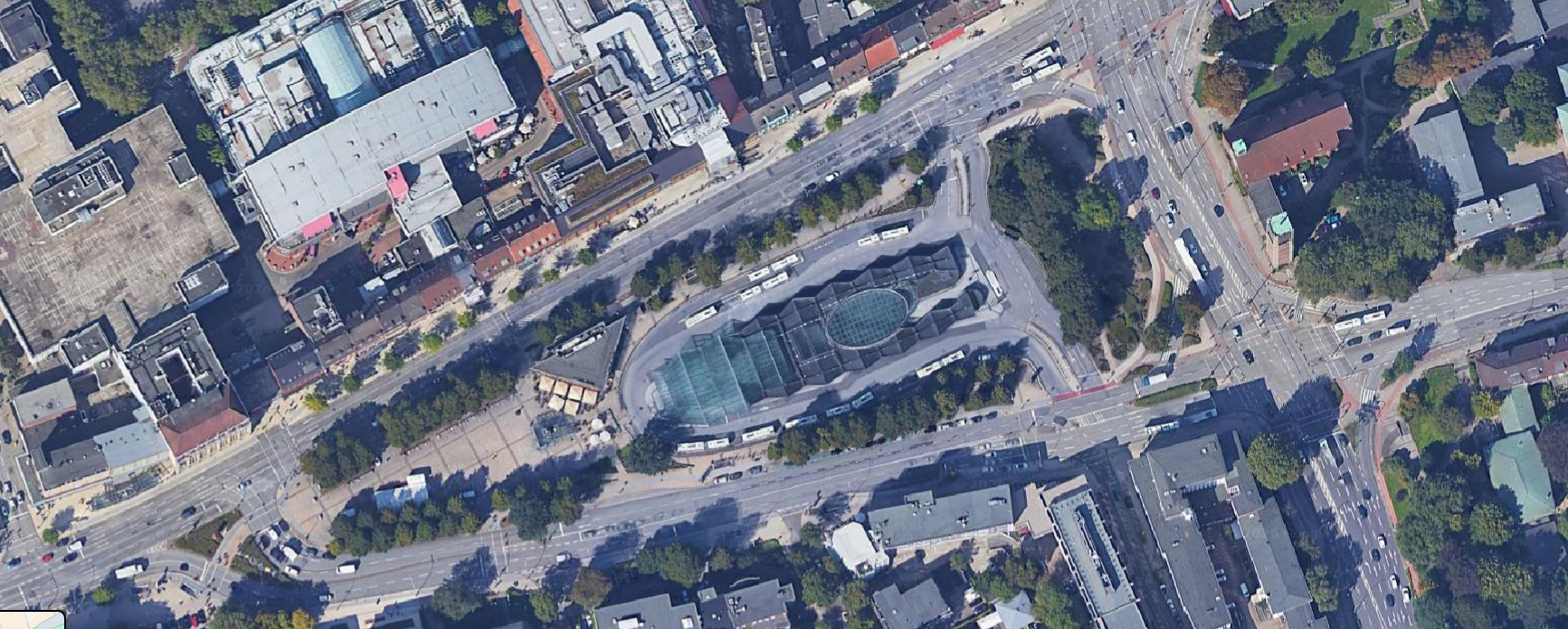
The name Wandsbek Markt suggests a traditional market square, as there are several such squares in Hamburg. However, the area has evolved far beyond its original market function. Today, Wandsbek Markt is primarily known as a major public transport hub in the east of Hamburg, surrounded by retail, traffic infrastructure and everyday urban activity. Wandsbek Markt, however, is not only a transport node. It is a layered public environment shaped by circulation, waiting, commerce and social encounters.

This project examines how the area functions and how it is perceived. The maps below isolate specific themes, making visible relationships that are difficult to understand when every layer is displayed at once.

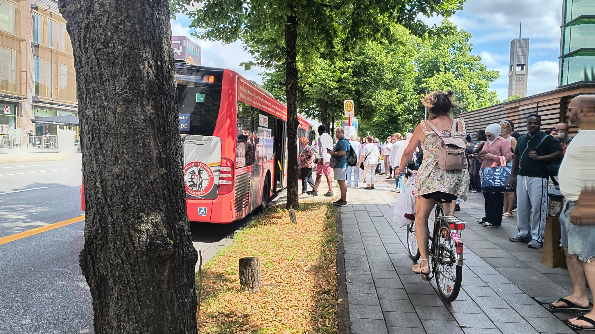
Street-level view of Wandsbek Markt
Field photograph Wandsbek Markt · 2026
02

Four ways of reading the same place.

01 / 04

Movement network

Public transport

This map shows the public transport network around Wandsbek Markt. It includes important bus stops, train connections and interchange points. The map highlights the main movement and public transport connections around Wandsbek Markt. At the same time, some of these connections also function as barriers, particularly where transport infrastructure divides pedestrian spaces. Especially relevant is the system of underground corridors, which connects the underground subway station with the surrounding streets and the bus interchange. These corridors are not only used for movement, but also accommodate gastronomy, retail and various services. In total, 12 entrances provide access to the underground corridor system. The map demonstrates how strongly the area is shaped by daily movement and interchange. Many people use Wandsbek Markt primarily as a place to arrive, leave or transfer between different forms of transport, making circulation one of the defining characteristics of the area.

Open full map
02 / 04

Spatial tension

Conflict places

This map identifies places where different activities and users come into conflict. Pedestrians, cyclists, buses and cars frequently share the same spaces around Wandsbek Markt, creating points of friction and uncertainty. Conflicts are particularly visible around the bus stops, bicycle routes and pedestrian crossings, where different movement patterns overlap. The entrances to the underground station also concentrate large numbers of pedestrians within relatively narrow spaces, increasing pressure on the surrounding paths and waiting areas. Other tensions arise where major roads and transport infrastructure interrupt pedestrian routes or make crossings less direct and comfortable. These overlapping movement patterns show how the area is not only a place of interchange, but also a space where different users compete for limited space.

Open full map
03 / 04

Urban structure

Road layout

The road layout demonstrates how the different street spaces are distributed around Wandsbek Markt. Although the area is strongly dominated by roads and car traffic, pedestrian areas are also widely present. However, these spaces are highly fragmented and often offer limited opportunities for comfortable movement or staying. Rather than forming a continuous pedestrian network, they function as a series of separate islands surrounded by heavily used roads. Pedestrians therefore have to cross several traffic corridors to move between different parts of the area. The extensive road network makes Wandsbek Markt highly accessible by car and public transport, but at the same time divides the public space into smaller and disconnected areas. Pedestrian movement is consequently shaped by crossings, traffic lights and transport infrastructure, making the road layout a significant factor in the quality and accessibility of the public realm.

Open full map
04 / 04

Human experience

Quality of public spaces

This map evaluates the quality of public spaces around Wandsbek Markt. The analysis considers seating, accessibility, safety, greenery, noise and opportunities to stay. The assessment shows considerable differences between individual spaces. Areas with greenery, seating and opportunities to stay offer a more comfortable and inviting environment, while spaces directly exposed to traffic are more strongly affected by noise, movement and limited possibilities for staying. The central areas around Wandsbek Markt combine several qualities, but their potential as public spaces is often limited by their function as transport and circulation areas. The map therefore highlights a broader contrast between spaces designed primarily for movement and spaces that support staying, interaction and everyday public life.

Open full map
03

One place.
Multiple opportunities.

The proposals form a connected network of interventions around Wandsbek Markt, addressing different situations identified through the site analysis. Rather than treating each location separately, the interventions work together to improve movement, accessibility and the quality of public space across the area. Select a concept to explore how individual locations could be transformed into safer, greener and more comfortable places for everyday use — from waiting and mobility to staying, social interaction and recreation.

Aerial map of Wandsbek Markt 1 2 3 4 5 6 7
Wandsbek Markt Connected interventions
Final principle

Wandsbek Markt should evolve from a place people mainly pass through into a public space that people also enjoy using.

04

References.

The study combines field observation, project photography, interactive mapping and publicly available geographic imagery.

01

Base mapping

OpenStreetMap contributors

Geographic base data used in the interactive maps. Map data © OpenStreetMap contributors, available under the Open Database License.

View attribution
02

Interactive mapping

uMap · OpenStreetMap Deutschland

Platform used to publish the public transport, conflict, road-layout and public-space-quality maps presented in this website.

Open uMap
03

Site imagery

Google Maps, Street View and aerial imagery

Street-level and aerial images of Wandsbek Markt were used to document spatial conditions and locate the proposed interventions. Imagery shown in the project includes February 2019 and October 2022 views.

Open Google Maps
04

Primary material

Project-team fieldwork, Hamburg, 2026

Field photographs, direct observation, movement mapping and spatial assessments produced by Mateusz Ślusarek, Urtine Elshani and Xheneta Xhemajli during the Data & Perception 2026 workshop.

05

Design communication

AI-assisted concept visualizations, 2026

The proposal images are conceptual overlays developed from the project’s site photographs. They communicate possible interventions and should not be read as final architectural plans.

Online sources accessed 30 July 2026.